 |
 |
|
|
|
Well, I did it. I climbed Mt. Whitney yesterday, and I have the pictures (and the overall soreness!) to prove it. I actually had no idea how hard it was going to be, or how dangerous; in fact, before this I had little comprehension of the difference between hiking Mt. Whitney (basically, walking up the trail) and climbing Mt. Whitney (actually, er, climbing, as in hanging from rocks with 100' of nothing below you).
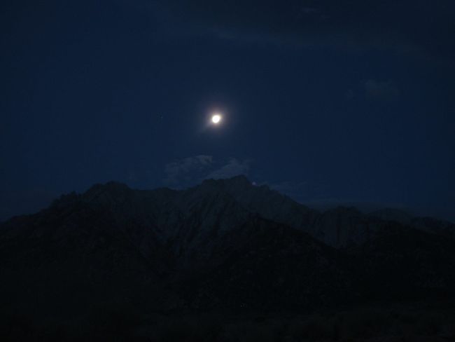
My friend Mark Elliot and I climbed up the "moutaineer's route" to the summit, and then descended the trail back to the Whitney Portal; overall it took us about sixteen hours. I would not recommend trying to do this in one day, but we did it :) Our day started at oh-dark-hundred in Lone Pine (actually, about 5:00AM); the peak of Mt. Whitney was barely visible in the darkness, framed by the moon.
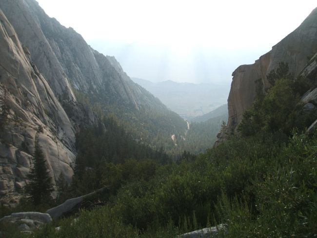
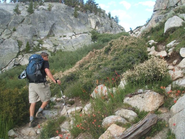
After a big breakfast (!) and driving up to the portal, we began the hike around 0700; as we climbed up, the views back down the valley to the East were amazing.
After about two hours (and some rather, um, interesting climbing up "the ledges") we reached Lower Boy Scout Lake.
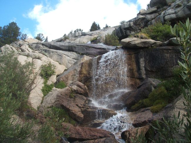
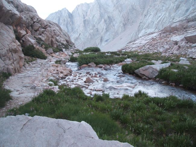
The beauty of these high meadows is incredible.
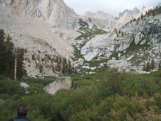
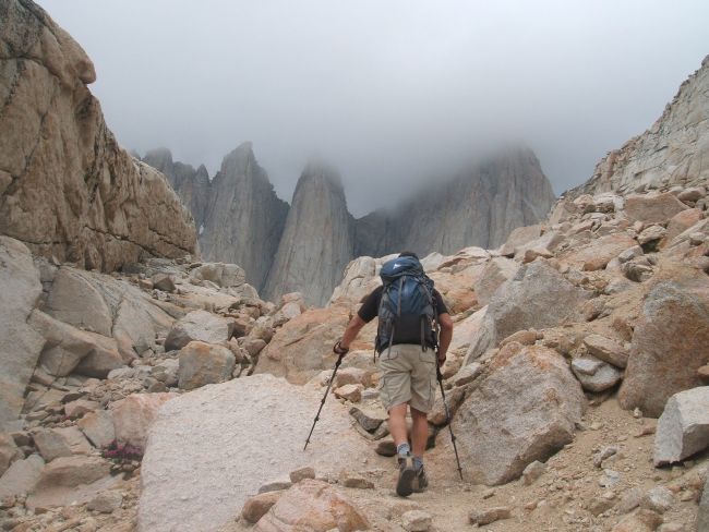
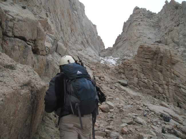
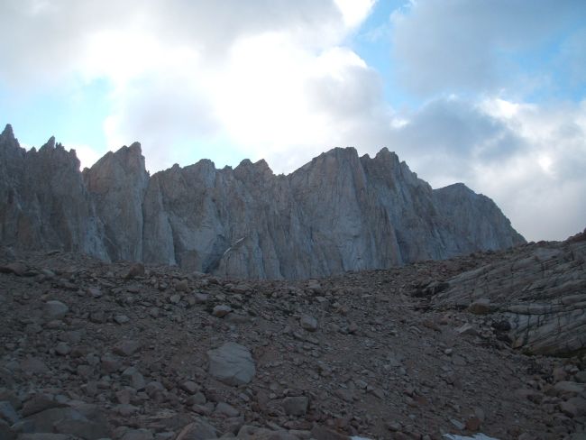
After some serious climbing - and about 3 1/2 hours after starting out - we reached Upper Boy Scout Lake. Here the foliage turns to rock, and the mountains really begin.
At this point the weather began looking iffy, and we weren't sure if we could make it to the top. Fingers crossed, and much scrambling over the talus ensued.
Finally, five hours after starting, we reach Iceberg Lake. Now the serious fun began, and man I must tell you, looking up at those peaks is intimidating!
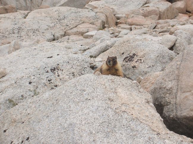
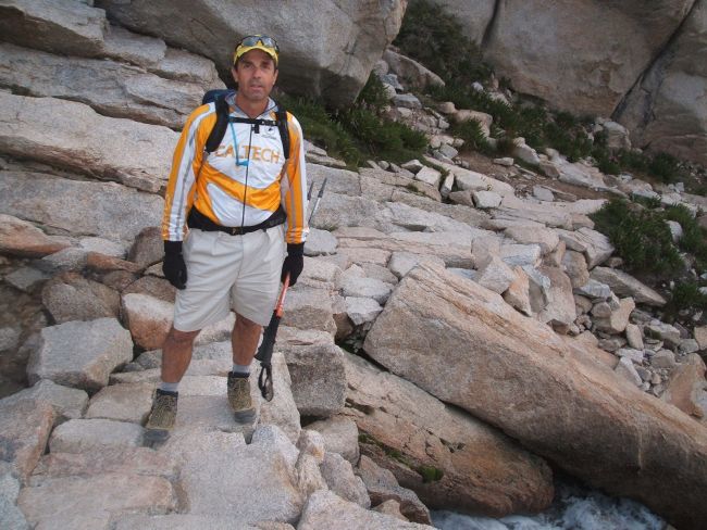
We stopped here for lunch, taking in the scenery while refueling. Fortunately we were not affected by the altitude; although people frequently camp here you are warned about altitude sickness. We also met some of the locals...
Then onward; about 2,000' left, much of it seemingly straight up (!). Now the difference between hiking and climbing really became apparent. Making things even more fun, the East chute was filled with some icy snow. Whoa.
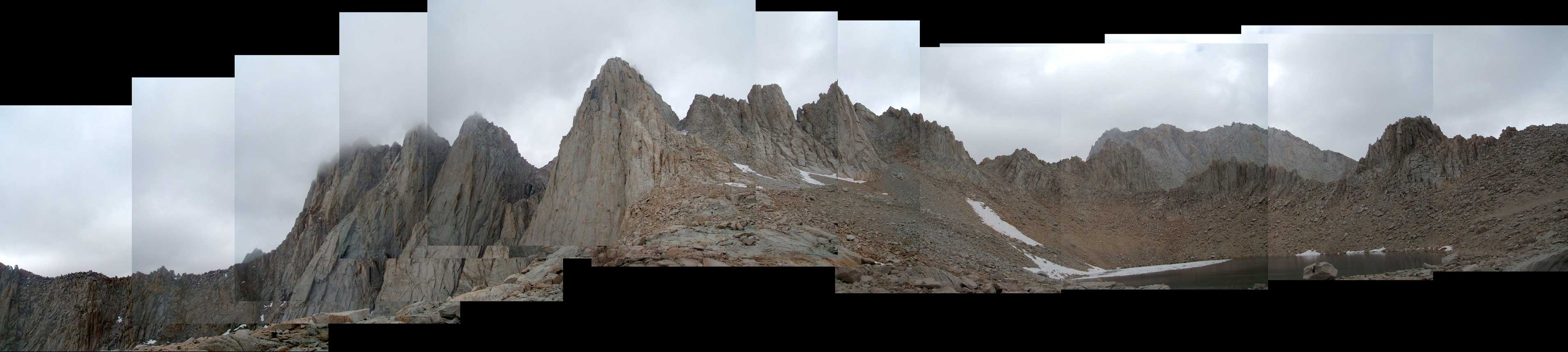
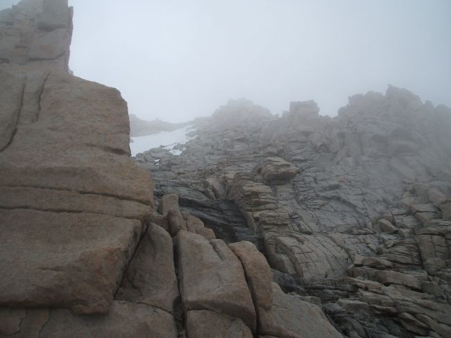
Still we proceeded slowly and methodically, and made it to the notch. After 6 1/2 hours, we are nearly there. The views in every direction are unbelievable, and you must try not to think about the exposure.
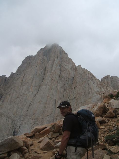
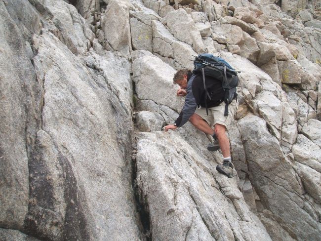
Now there was a little matter of climbing the North face to the summit. This is considered a "class 3" climb, but whatever you call it, this is serious. It just doesn't do to think about falling.
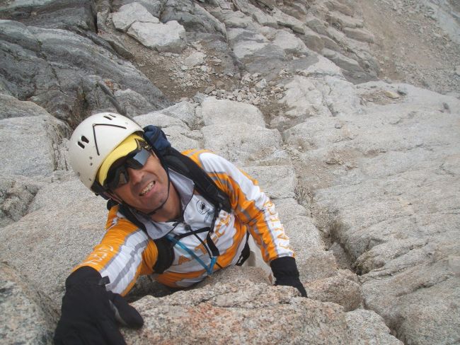
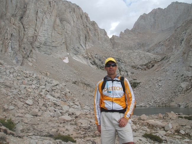
Fortunately Mark is an experienced climber, and a solid guide. We took our time and he roped us through a particularly tricky section, entering the face. I must say in retrospect this was the best part of the climb; methodically working our way from hold to hold. There were some really cool sections, including a 'chimney' to wedge through near the top, and it was really fun. I really like rock climbing, who knew?
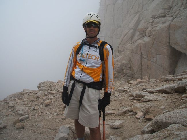
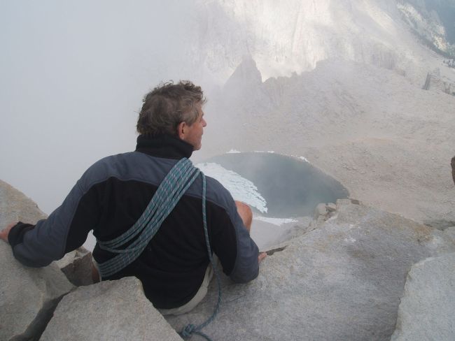
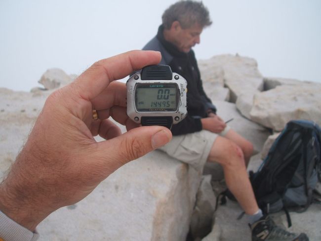
That picture of me at the top of this post was taken by Mark, about halfway up the North face. Woo hoo. So after a very concentrated hour, we made it! Eight hours after starting out, and 6,000' higher.
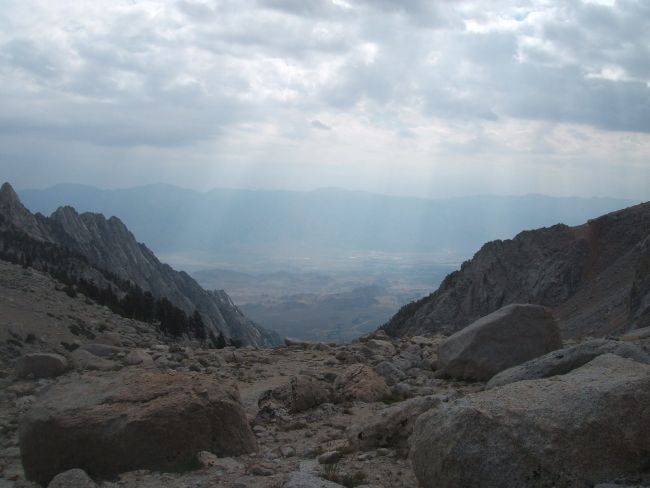
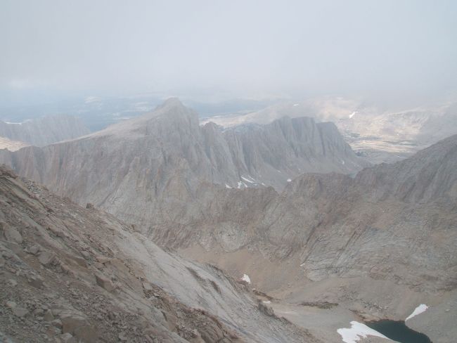
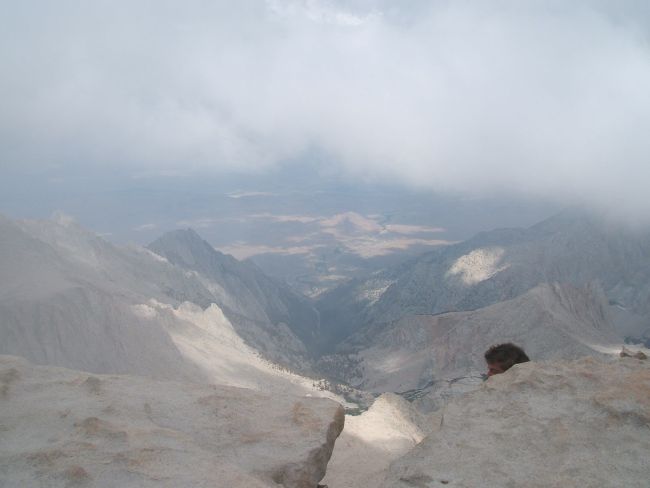
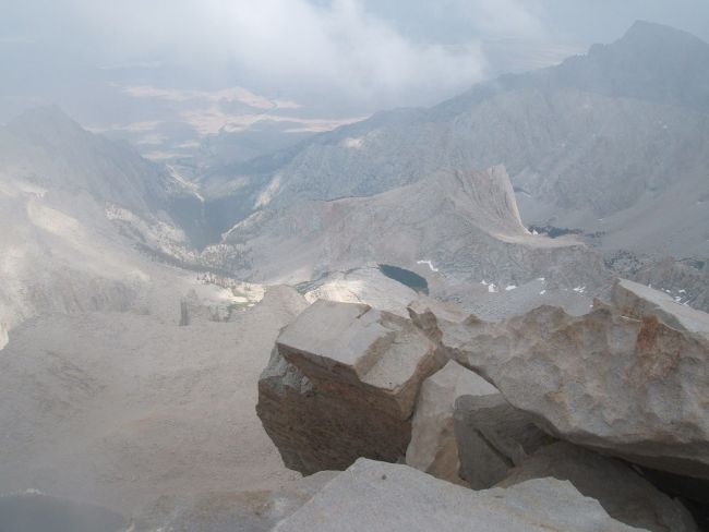
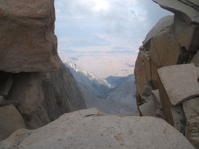
The feeling of vertical dimensionality you get, standing at the highest point in the U.S, looking down in every direction is hard to explain. Of course I've looked out an airplane window, but this is pretty different. The volumes of air are apparent, and the Earth looks curved.
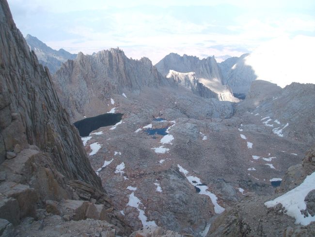
After gazing for a while and eating and drinking, we took off back down the Whitney Trail; 11 miles of switchbacks. The trail begins by heading South behind the Keeler Needles and Mt. Muir, before joining the Muir Trail at the "Trail Crest".
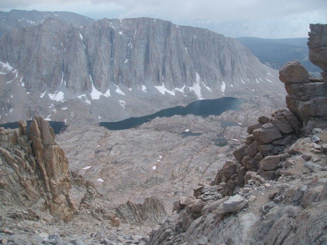
At that point the trail heads down and East, along a different valley to the one we climbed up. The views back along the ridge toward the peaks were incredible; it was hard to believe we had been standing "up there" just two hours ago.
The path down the remainder of the valley was long but amazingly beautiful in the fading light...
Six hours later, we were back at the car; no problem :) So, eight hours of And I may ask myself, how did I get here?
|

|